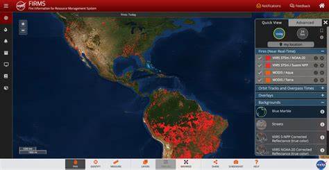
The FIRMS tool is being used by internet sleuths to track the Ukraine-Russia war. NASA created the Fire Information for Resource Management System (FIRMS) NASA has been using satellites to track fires since at least 2000. It aids firefighters and other first responders to identify wildfires across the globe.
The FIRMS technology
The technology uses NASA satellites with infrared sensors to create heat images. On the FIRMS website, red dots show up on a Google Earth-type map of the world. Each dot is a representation of an explosion or a fire that can be pinpointed by zooming in.
Since the Russian invasion of Ukraine, the images show multiple blazes. The line of fires correlates with the front lines of fighting in eastern and southern Ukraine.
Fires created by the war include shelling, burning munitions depots, and other explosions which generate heat appear on the NASA satellite-directed mapping program.
The Ukraine-Russia conflict may be the first war ever covered in real-time. And FIRMS technology has never before been used to track a conflict at this scale.


