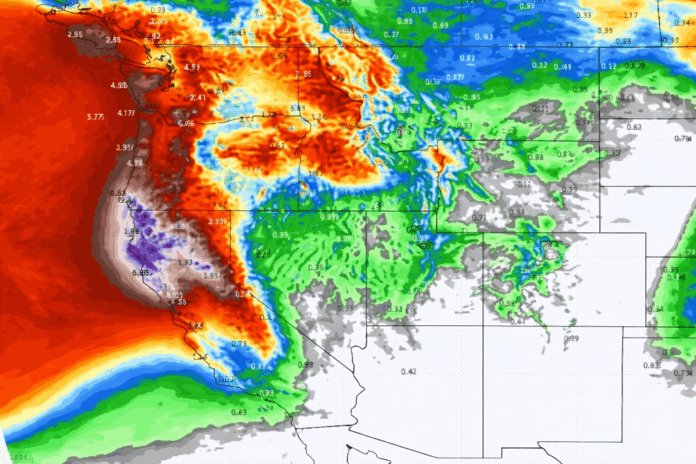
- The warning was immediate.
- The system intensified faster than forecast.
- The scale has pushed forecasters into rare territory.
Meteorologists warn this is not a routine storm as extreme atmospheric and solar factors converge.
[USA HERALD] – California entered a heightened state of alert after the National Weather Service issued weather warnings covering the entire state, citing a rapidly developing bomb cyclone forming off the Pacific coast. According to forecasters, the system is undergoing explosive cyclogenesis, a process in which surface pressure drops so quickly that storms can strengthen to near-hurricane intensity in less than 24 hours. The result is a high-impact scenario involving damaging winds, torrential rain, flash flooding, coastal hazards, and mountain snow—all unfolding on an unusually compressed timeline.
What immediately separates this event from typical winter storms is both its speed and scale. Bomb cyclones are not unheard of along the West Coast, but statewide warnings are rare. Internal briefings and expert commentary describe the system as aggressive, expansive, and difficult to model with standard confidence. One analyst familiar with space-weather conditions described the broader environment bluntly: “This is not normal, possibly the largest in the top five coronal holes for the 21st century.”
Coronal holes are vast regions of the Sun where magnetic field lines open outward, allowing high-speed solar wind to stream into space. When Earth intersects these streams, the planet’s magnetosphere and upper atmosphere absorb that energy. While coronal holes do not directly “cause” storms, their effects on atmospheric circulation and upper-level dynamics are well documented. Enhanced solar wind can subtly alter pressure gradients, jet stream behavior, and atmospheric coupling—factors that matter when a weather system is already primed for rapid intensification.
In this case, meteorologists are watching a storm that is strengthening faster than most numerical models initially projected. Pressure falls offshore have been steep, wind fields broad, and moisture transport unusually efficient. These characteristics align with textbook bomb cyclone behavior, but the extremity of the forecast has forced forecasters to emphasize risk communication over routine advisories. Emergency managers across California have been urged to prepare for widespread impacts rather than isolated regional effects.
From a forensic weather-analysis perspective, timing is critical. The overlap between extreme solar conditions and an already unstable Pacific system does not prove causation, but it does warrant closer examination. Atmospheric science recognizes that Earth does not operate as a closed system. Energy inputs from above, even when indirect, can act as amplifiers in moments of instability. When those inputs coincide with favorable ocean temperatures, strong baroclinic zones, and upper-level support, the margin for error narrows quickly.
Agencies including NASA and NOAA have long studied the connections between solar activity and Earth’s atmosphere, particularly during periods of heightened geomagnetic stress. While the immediate focus remains public safety and storm response, the data generated by this event will likely be analyzed well beyond the forecast window. Events that strain models often become the ones that refine them.
For Californians, the message is straightforward and urgent: this is not a routine storm cycle. Officials are warning of power outages, hazardous travel, coastal flooding, and life-threatening conditions in vulnerable areas. For scientists and forecasters, the event represents another data point in an evolving understanding of how extreme systems behave when multiple environmental stressors converge.
We will continue monitoring conditions as forecasts update and impacts unfold across the state.


