Powerful Japanese Earthquakes Hit Cities, Trigger Tsunami Warnings
America ı By Jackie Allen
0 Comments

On Monday, powerful Japanese earthquakes left dozens dead and thousands without power. The Japan Meteorological Agency reported a staggering 21 earthquakes, with a magnitude of 4.0, or higher within just over an hour and a half.
Satellite images vividly depict the widespread destruction in cities such as Suzu and Wajima. And showcase capsized boats, decimated buildings, and massive fissures.
This seismic event, marked by a 7.6 magnitude quake, triggered tsunami warnings, causing panic and evacuations.
Sunshine State Sonar Locates Missing Orlando Woman After More Than a Decade - USA Herald
Epstein Associates Exposed: Names of 150 Set to Go Public - USA Herald
Satellite Images of Coast

The destruction is visible from space, with satellite images revealing the extent of the damage along Japan's west coast and inner cities.
The seismic activity triggered tsunami warnings, heightening the sense of urgency. Fortunately, these warnings were eventually lifted, but not before some areas experienced significant waves.
The city of Wajima faced nearly 4-foot-high waves, and Kanazawa saw waves reaching almost 3 feet. Rescue teams continue to navigate challenging conditions to reach those trapped and provide assistance.
Measuring at an estimated 7.6 magnitude, Monday's earthquake has left a lasting impact.
The ground rose by over 13 feet in some areas and shifted more than 3 feet in others. Aftershocks, persisting into Wednesday, contribute to the ongoing challenges.
As of Tuesday, the death toll stands at 62, with rescue teams continuing to work to locate survivors amidst the rubble.
Japanese Earthquakes
This recent seismic event is drawing comparisons to Japan's 2011 9.0 magnitude earthquake, which resulted in nuclear meltdowns at the Fukushima plant and claimed the lives of 18,000 people.
However, the current earthquake's lower magnitude, combined with Japan's robust emergency preparedness system, has helped keep the death toll lower.
Japan's awareness and readiness for seismic activity has played a crucial role in mitigating the impact of earthquakes.
Strict building guidelines ensure that structures must withstand shaking, and advanced earthquake alerts provide up to 20 seconds of notice before the most severe tremors begin.
This preparedness stands in stark contrast to other regions, like Turkey, Syria, Morocco, and Afghanistan, where earthquakes of similar or lower magnitudes have resulted in more devastating death tolls.
The Historical Context
Japan has a history of devastating tsunamis, with the 2011 tsunami, triggered by a 9.0 magnitude earthquake, leading to the Fukushima Daiichi nuclear disaster and claiming over 18,000 lives.
The recent earthquake reignites fears of tsunamis, prompting government spokesperson Yoshimasa Hayashi to issue urgent evacuation calls to coastal areas.
According to the US National Oceanic and Atmospheric Administration website, any waves with runups over one meter (3.28 feet) can be particularly dangerous to people living in coastal areas. This includes the possibility of flooding, strong currents, and future erosion.
Wajima in Ishikawa prefecture reported tsunami waves of almost four feet, while Toyama prefecture and Kashiwazaki in Niigata prefecture experienced smaller waves.
With the threat of tsunamis, local coastal residents were urged to evacuate.
The combination of advanced earthquake preparedness, efficient emergency response, and continuous efforts by rescue teams has been instrumental in minimizing the devastation.

Discussion
No comments yet. Be the first to join the discussion!
FOLLOW US
Recent Posts

US Inflation Rate Drops to 3.5% in June

The Manosphere: Social Media’s Growing Influence Raises Concerns After Violence…

UFO Sightings: Scientists Say Alien Life Is Likely as Decades…

H.R. 9237 Sparks Fight Over Future VA Disability Benefits

Social Media Oversharing Fuels Identity Theft

Anthropic Emerges as AI Leader After Elon Musk Publicly Admits…

Lab Scandal: JonBenét Ramsey Investigation Continues as Father Pushes for…
Don’t Miss It
Graham Senate Seat Triggers Political Scramble
By – Michallie HarrisonSouth Bow to Pay Nearly $27M Penalty Plus $40M in Prevention Work and $3M to Kansas After 2022 Rupture Released 13,000 Barrels Into Mill Creek
By – Rihem Akkouchetwo killed in Toronto After Deadly street festival shooting
By – Rihem AkkoucheElephant Fire burns 4500 acres in Sierra County
By – Rihem AkkoucheLindsey Graham Death at 71 Stuns Washington After Senator’s Final Trip to Kyiv
By – Rihem AkkoucheLindsey Graham Dies at 71 After Sudden Illness: Tributes come from Trump and World Leaders
By – Jackie AllenJan. 6 Case: Judge Dismisses Proud Boys Prosecution at DOJ’s Request
By – Jackie AllenJack Antonoff Criticizes AI in Music, Calls Supporters “Godless Whores” in Angry Social Media Post
By – Jackie Allen
Kelly Warner Law Firm Blames USA…
In what appears as a desperate attempt to defend multiple…
By – USA Herald
Aaron Kelly Law Firm Resorts To…
Attorney Aaron Kelly and his law partner Daniel Warner are…
By – Jeff Watterson
Arizona Bar Opens Investigation on Attorney…
USA Herald recently reported on a developing story involving Attorneys…
By – Paul O'Neal
Oregon Withdraws Court Motion in Paramount-Warner…
Oregon blinked — but it did not back down. The…
By – Rihem Akkouche
1 dead After fire at Davis…
A Saturday morning that began like any other in South…
By – Rihem Akkouche
Apple Sues OpenAI Over Trade Secrets…
The partnership that placed ChatGPT inside hundreds of millions of…
By – Rihem Akkouche
NYT Air Force One Subpoena Targets…
They came on a Friday evening, to the homes of…
By – Rihem Akkouche
Gordie Howe Bridge to Open on…
Named for a hockey legend who won four Stanley Cups…
By – Rihem Akkouche
Teen Football Player’s Death on Uninhabited…
Christine and Elmore Wonsley are not sleeping. They cannot. A…
By – Rihem Akkouche
Teen Football Player’s Death on Uninhabited…
Christine and Elmore Wonsley are not sleeping. They cannot. A…
By – Rihem Akkouche
Hundreds Of People at Summer Camp…
The water came faster than the roads could handle and…
By – Rihem Akkouche
UFC Event Allegedly Targeted in White…
WASHINGTON, D.C. — A historic UFC Event held on the…
By – Jackie Allen
Russia Sanctions Bill Gains BiPartisan as…
WASHINGTON, D.C. — Russia Sanctions legislation moved closer to becoming…
By – Jackie Allen
Manhattanhenge 2026: Final Summer Sunset Alignment…
NEW YORK — Manhattanhenge is making its final appearance of…
By – Jackie Allen
Jared Isaacman Says NASA Has Unexplained…
WASHINGTON, D.C. — Jared Isaacman, the administrator of NASA, says…
By – Jackie Allen
Jared Isaacman Says NASA Has Unexplained…
WASHINGTON, D.C. — Jared Isaacman, the administrator of NASA, says…
By – Jackie Allen
Erika Kirk Seeks Public Release of…
Erika Kirk, the widow of Turning Point USA co-founder Charlie…
By – Jackie Allen
Bonnie Tyler Remembered as Legendary Welsh…
Bonnie Tyler, the Welsh singer whose unmistakable raspy voice powered…
By – Jackie Allen
Assault on Iran Escalates as U.S.…
The Assault on Iran intensified after the United States launched…
By – Jackie Allen
Broadcom Deal: Apple Commits More Than…
Apple is dramatically expanding its investment in American semiconductor manufacturing…
By – Jackie Allen
Arranged Marriage Ends in Tragedy: Amazon…
An Arranged Marriage that began in the summer of 2025…
By – Jackie Allen
Forensic Scientist Henry Lee’s Final Interview…
A legendary Forensic Scientist whose testimony influenced some of America’s…
By – Jackie Allen
Accused of Rape: Graham Platner Denies…
Accused of Rape, Maine Democratic U.S. Senate candidate Graham Platner…
By – Jackie Allen
AI Regulation Debate Intensifies After Peter…
The global debate over AI Regulation took a dramatic turn…
By – Jackie Allen
California Chaos: Fourth of July Celebrations…
California Chaos unfolded across parts of Southern California during the…
By – Jackie Allen
Paul Pelosi Faces Charge After Alleged…
Paul Pelosi, the husband of former House Speaker Nancy Pelosi,…
By – Jackie Allen
Beach Closures Expand Across Long Island…
Beach Closures were spread across parts of New York just…
By – Jackie Allen
Arranged Marriage Ends in Tragedy: Amazon…
An Arranged Marriage that began in the summer of 2025…
By – Jackie Allen
Beach Closures Expand Across Long Island…
Beach Closures were spread across parts of New York just…
By – Jackie Allen
Mars Rover Images Lead to Debates…
A new Mars Rover image captured by NASA’s Curiosity mission…
By – Jackie Allen
Taylor Swift and Travis Kelce’s Star-Studded…
Taylor Swift and Travis Kelce’s highly anticipated wedding is finally…
By – Rihem Akkouche
Federal Judge Sends Bad Bunny Reggaeton…
INSIDE THIS REPORT A federal judge denied summary judgment to…
By – Samuel Lopez
Mike Rowe Sues Discovery for $2…
Inside This Report Mike Rowe is suing Discovery, claiming the…
By – Samuel Lopez
The Hidden Science Behind Why Your…
For millions of people, the first conscious act of the…
By – Tyler Brooks
The High Cost of the Infinite…
A significant legal chapter is closing for one of the…
By – Tyler Brooks
Kentucky Medicaid Alert How The Upcoming…
A significant change is arriving for thousands of Kentucky residents…
By – Tyler Brooks
Everything You Need to Know About…
As the calendar turns to July 1, residents of Georgia…
By – Tyler Brooks
Trump Seeks $1.4 Billion as Congo…
The Trump Ebola funding request would provide more than $1.4…
By – Michallie Harrison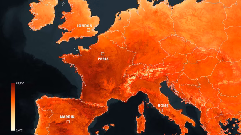
Temperatures in France were higher than…
The images coming out of Europe this week are nothing…
By – Tyler Brooks
Taylor Swift Wedding Reports Claim Private…
Taylor Swift Wedding speculation intensified after reports claimed that pop…
By – Jackie Allen
Justice Served as Former NFL Scout…
The Nashville courtroom fell silent this Wednesday as a jury…
By – Tyler Brooks
Stonewall Riots: An Uprising That Changed…
The Stonewall Riots marked one of the most significant turning…
By – Jackie Allen
USMNT Lost to Turkey at 90+8.…
Kaan Ayhan’s goal came in the 90th minute, plus eight.…
By – Nicolas Carreno
Tears, Goals, and the Siuuu: IShowSpeed’s…
The 2026 FIFA World Cup has been a rollercoaster of…
By – Tyler Brooks
World Cup History Made as Lionel…
World Cup history was made Monday afternoon in Arlington, Texas,…
By – Jackie AllenNo posts found.
No posts found.

Join the Discussion
Share your thoughts, ask questions, and engage with
other readers. Sign in or create a free account to
comment.