Thousands flee, Hurricane Laura upgraded to category 4 storm
America ı By Jackie Allen
440 0 Comments

--------------------------------------------------
Have a story you want USA Herald to cover? Submit a tip here and if we think it's newsworthy, we'll follow up on it.
Want guaranteed coverage? We also offer contract journalism here. Just be sure you're comfortable giving up editorial control because our journalists are dogged and will follow the story through to the conclusion. The story will be published to our exacting standards, without regard for your preferred slant.
Want to contribute a story? We also accept article submissions -- check out our writer's guidelines here.
FOLLOW US


Recent Posts

CAF Strips Senegal from Title, Morocco Crowned 2025 AFCON Champions

IBM Completes Confluent Acquisition, Ushering in Real-Time AI Data Era

Aden Holloway Marijuana Charge Casts Shadow Over Alabama Ahead of…

Georgia VA Clinic Shooting Sparks Multi-Agency Investigation After Deadly Confrontation

SpaceX Launch Lights Up California Sky as Falcon 9 Sends…

Kouri Richins Convicted of Poisoning Husband in Chilling Utah Murder…

Cause of a Meteor in Northeast Ohio Traced to Explosive…
Don’t Miss It
MTA Sues Trump Administration Over Subway Funding in High-Stakes Infrastructure Clash
By – Rihem AkkoucheThe Lycra Files for Chapter 11 in Bid to Untangle $1.2 Billion Debt
By – Rihem AkkoucheJoe Kent Resigns, Exposing Deep Divisions Over Iran War
By – Rihem AkkoucheGregory Bovino Retirement Ends Controversial Border Patrol Career
By – Rihem AkkoucheNew Molten Planet Identified, Revealing Possible New Class of Alien Worlds
By – Rihem AkkoucheBank of America Epstein Survivors’ Lawsuit Settlement Reached in High-Profile Abuse Case
By – Rihem AkkoucheWiles Announces Cancer Diagnosis as White House Chief of Staff Continues Duties
By – Rihem AkkoucheEuropean Publishers Google Probe Intensifies as EU Faces Pressure to Act
By – Rihem Akkouche
Kelly Warner Law Firm Blames USA Herald for Arizona Bar Investigation
5/17/17 Based on the information released in The Washington Post article on 5/17/17, the USA Herald publishes another in-depth article that…
By – USA Herald
Aaron Kelly Law Firm Resorts To Attacking Former Client Again On KellyWarnerLaw.com – Pattern Recognized
Professor Volokh thereafter filed a bar complaint against Dan Warner with the Arizona Bar. This eventually led the ABA to…
By – Jeff Watterson
Arizona Bar Opens Investigation on Attorney Aaron Kelly
USA Herald recently reported on a developing story involving Attorneys Daniel Warner and Aaron Kelly. Both Warner and Kelly have…
By – Paul O'Neal
Apple AirPods Max 2 Launch Unveils Powerful Audio Upgrades and Smart Features
Gaming and Entertainment Get a Boost Gamers could also benefit from reduced wireless audio latency. With Game Mode enabled across…
By – Rihem Akkouche
Trump’s Pastor Paula White Draws Scrutiny As Religion Enters Iran War Debate
INSIDE THE REPORT As tensions between the United States and Iran intensify, a parallel debate has erupted online and across…
By – Samuel Lopez
10-Year-Old Stabbing Luxury School Sparks Shock in Mountain View
A violent incident on a playground in a wealthy California enclave left parents and residents reeling after a 10-Year-Old stabbing…
By – Rachel Moore
Baltimore Teacher Elementary School Death Shocks Community
Community Mourns a Dedicated Teacher For more than two decades, Tolson helped students overcome academic challenges and build confidence in…
By – Rachel Moore
2k US Flights Cancelled as Midwest Blizzards Paralyze Major Airports
Atlanta Hub Also Feels the Shockwaves The storm’s reach extended far beyond the Midwest. At Hartsfield–Jackson Atlanta International Airport, one…
By – Rachel Moore
Infant Killed in Ambulance Crash After Drunk Driver Runs Red Light in Philadelphia
A heartbreaking tragedy unfolded early Sunday morning in Philadelphia, where an infant killed in ambulance crash has left a community…
By – Rachel Moore
Infant Killed in Ambulance Crash After Drunk Driver Runs Red Light in Philadelphia
A heartbreaking tragedy unfolded early Sunday morning in Philadelphia, where an infant killed in ambulance crash has left a community…
By – Rachel Moore
Heat Wave Warning for Southern California Signals Historic March Temperatures
Scientists Call It a “Summer Heatwave in March” Climate and weather researchers say the event is highly unusual. Weather scientist…
By – Rachel Moore
US Service Members in Iraq Plane Crash Identified After Deadly Military Incident
Six U.S. service members killed in Kuwait One American soldier killed in Saudi Arabia Multiple Aircraft Losses During Conflict The…
By – Rachel Moore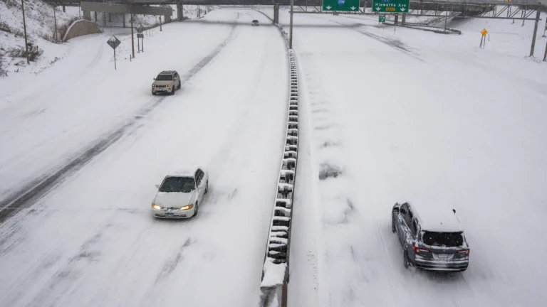
Major March Snowstorm Paralyzes Minnesota as Travel Warnings Spread
Strong Winds Create Dangerous Visibility In addition to snowfall, the storm unleashed powerful wind gusts of 30 to 50 mph,…
By – Rihem Akkouche
Hapag Lloyd to Acquire ZIM as Executives Sell Millions in Shares Ahead of Deal
Political Resistance Emerges Despite the agreement, the transaction still faces multiple approvals. The deal must receive backing from ZIM shareholders…
By – Rihem Akkouche
Sharks in the Chicago River? Viral Sightings Turn Out to Be a Clever Movie Stunt
Residents and tourists in Chicago did a double take Saturday morning as mysterious fins sliced through the bright green water…
By – Rihem Akkouche
Sharks in the Chicago River? Viral Sightings Turn Out to Be a Clever Movie Stunt
Residents and tourists in Chicago did a double take Saturday morning as mysterious fins sliced through the bright green water…
By – Rihem Akkouche
Raytheon Satellite Terminal Contract Expanded by $2 Billion in U.S. Air Force Deal
The U.S. military has dramatically expanded a key defense communications program, boosting the Raytheon satellite terminal contract by more than…
By – Rihem Akkouche
Meta 20% Workforce Cut Could Reshape Tech Giant as AI Spending Surges
Intensifying AI Competition Across Big Tech Meta’s aggressive AI expansion comes amid an escalating technological arms race among the world’s…
By – Rihem Akkouche
Thomas Medlin Found Dead in Brooklyn Waters After Two-Month Search
A tragic chapter in a months-long search ended this week after authorities confirmed Thomas Medlin found dead, bringing painful closure…
By – Rachel Moore
American Refuelling Aircraft Crashed in Iraq During Military Operation
Investigation Into Crash Underway Military investigators are now working to determine what caused the accident after the American refuelling aircraft…
By – Rachel Moore
Astronomers Witness Birth of a Magnetar in Explosive Cosmic Event
A Supernova’s “Chirps” Reveal the Hidden Engine The breakthrough occurred when astronomers analyzed unusual signals in the brightness pattern—known as…
By – Rachel Moore
Arizona Man Accused of Crucifying Pastor Pushes Judge For A Quick Death Sentence
By Samuel A. Lopez | USA Herald – An Arizona courtroom is now the center of a deeply disturbing case…
By – Samuel Lopez
Trump’s Laser Talk Sparks New Questions About America’s Secret Arsenal
On the American side, the evidence also points to a military that is pushing hard into directed energy rather than…
By – Samuel Lopez
The Northern Lights Return
The Northern Lights have a chance to be visible from several northern U.S. states on Tuesday night, forecasters at the…
By – Jackie Allen
February Unemployment Up as Job Losses Surprise Economists
According to the BLS: Producer prices rose 2.9% year-over-year through January 2026 Core PPI increased 3.6%, excluding food and energy…
By – Jackie Allen
Late-Night Attack by Venezuelan National at Florida Beach
Officials noted that the suspect had overstayed his work visa at the time of the attack. For more details on…
By – Jackie Allen
Trump’s War in Iran: Congress Confronts Escalation After U.S. Strikes
On the Republican side, most lawmakers appear to back Trump’s strategy. Sen. Tom Cotton (R-Ark.), chair of the Senate Intelligence…
By – Jackie Allen
AI Deepfake Warfare Emerging As The Next Legal Battlefield In 2026 Election Cycle
Inside This Report Artificial intelligence can now generate hyper-realistic videos and voices that are nearly impossible to distinguish from reality—raising…
By – Samuel Lopez
A Violent July 4 Attack Leads To Federal Convictions For Nine Antifa Cell Members Convicted In Prairieland ICE Detention Center Shooting
Three Critical Points Readers Should Know A federal jury convicted nine alleged members of a North Texas Antifa cell for…
By – Samuel Lopez
Trump UFO Directive Could Shake Religion Science And Power Structures Worldwide
By Samuel A. Lopez | USA Herald – Something unusual is happening in Washington. President Donald Trump has ordered federal agencies to…
By – Samuel Lopez
Ancient Astronomers Warned That Strange Skies Precede Global Upheaval—Why Their Writings Are Being Revisited Today
In the Western world, Greek astronomers also sought to connect celestial movements with earthly events. Claudius Ptolemy, writing in…
By – Samuel Lopez
Oil, War, and the Insurance Shockwave Already Hitting America
Each reassessment has financial consequences. War-risk surcharges are typically calculated as a percentage of the vessel’s value. For a…
By – Samuel Lopez
US Navy Prepares To Escort Tankers Through Strait of Hormuz As Oil War Risks Escalate
By Samuel A. Lopez | USA Herald – The world’s most important oil chokepoint may soon be guarded by U.S. warships.…
By – Samuel Lopez
War Insurance Reality Americans Face Even When the Battlefield Is Overseas
However, most Americans are unaware that their own policies contain similar boundaries. If a missile strike or military action directly…
By – Samuel Lopez
Supreme Court Asked To Step In As 98-Year-Old Federal Judge Pauline Newman Fights Suspension From The Bench
[USA HERALD] – For more than four decades, one of the most influential judges in American patent law helped shape…
By – Samuel Lopez
Iran Appears To Have Conducted Its First Major Cyberattack Against A U.S. Company, Since The War Began – New Front Opens Against American Healthcare
Public reporting has pointed to a likely abuse of Microsoft Intune-style device management functions. Sophos threat intelligence director Rafe Pilling…
By – Samuel Lopez
Beyond Gas Prices The Strait of Hormuz Crisis Could Hit Fertilizer, Plastics, Aluminum And Global Supply Chains
Plastics and petrochemicals are another underappreciated vulnerability. Middle Eastern producers ship enormous volumes of chemicals and plastics through this route,…
By – Samuel Lopez
When The Files Are Finally Unsealed The Most Mind-Bending Truth May Not Be What We Expect
[USA HERALD] – There is a widespread assumption that if governments release their most highly classified files related to unidentified…
By – Samuel Lopez
Civil Rights Icon Rev. Jesse Jackson Dies at 84 As President Trump Issues Personal Tribute
Even in later years, as illness softened his voice and slowed his step, Jackson remained active. In 2021, he was…
By – Samuel Lopez
The World Cup Security Reckoning: Trump Warns Iran Soccer Team About Safety As War Tensions Spill Into Global Sports
By Samuel A. Lopez | USA Herald – A short Truth-Social post from President Donald Trump on Thursday morning is now…
By – Samuel Lopez
Trump’s War in Iran: Congress Confronts Escalation After U.S. Strikes
On the Republican side, most lawmakers appear to back Trump’s strategy. Sen. Tom Cotton (R-Ark.), chair of the Senate Intelligence…
By – Jackie Allen
Cadillac Names Inaugural Formula 1 Car MAC-26 in Tribute to Mario Andretti Ahead of 2026 Australian Grand Prix Debut
Lowdon has previously spoken about Andretti’s early encouragement during the team’s formation stages, noting that the racing legend asked him…
By – Ahmed Boughalleb
Norway Tops Medal Table After Day 13 at 2026 Winter Olympics as Team USA Surges Into Second Place
With 13 days complete at the 2026 Milan Cortina Winter Olympics, Norway sits atop the overall medal standings, collecting 34…
By – Ahmed Boughalleb
Olympic Science Explained: How Figure Skaters Spin at Blinding Speeds Without Getting Dizzy
When Amber Glenn finishes her routine, the arena usually rises with her. The music builds, her blades carve a tight…
By – Tyler Brooks
Olympic Villages Run Out of Condoms at 2026 Milan-Cortina Games
Condom supplies in the Olympic Villages at the 2026 Winter Games have been temporarily depleted, the Milan-Cortina organizing committee confirmed,…
By – Tyler BrooksNo posts found.
No posts found.
 No comments yet. Be the first to comment!