Kelly Warner Law Firm Blames USA Herald for Arizona Bar Investigation
6/25/17 Learning of Mr. Levy’s filing to vacate another fraudulent order that the Kelly Warner Law Firm was involved in,…
By – USA HeraldAaron Kelly Law Firm Resorts To Attacking Former Client Again On KellyWarnerLaw.com – Pattern Recognized
Professor Volokh thereafter filed a bar complaint against Dan Warner with the Arizona Bar. This eventually led the ABA to…
By – Jeff WattersonArizona Bar Opens Investigation on Attorney Aaron Kelly
USA Herald recently reported on a developing story involving Attorneys Daniel Warner and Aaron Kelly. Both Warner and Kelly have…
By – Paul O'NealMexico To Ban Cash At The Pump And The Toll Booth — Sheinbaum Orders Digital-Only Payments By End of 2026
Whether the government can build the infrastructure, close the access gap, and bring along a deeply skeptical public before its…
By – Samuel LopezNASA Is Sending Human Tissue To The Moon — And Calling It ‘Avatar’
HOUSTON, Texas — NASA has named a lot of things over its seven-decade history: rockets, rovers, telescopes, and orbital stations. The…
By – Samuel LopezArtemis II Raises New Questions As Spacecraft Toilet Malfunctions And Burning Odor Reported Mid-Mission
INSIDE THIS REPORT A mission designed to showcase the future of American space exploration is now raising uncomfortable questions about…
By – Samuel LopezDEVELOPING: Driver Plows Into Louisiana Parade Leaving Multiple Injured As Authorities Say Suspect Was Intoxicated
DEVELOPING STORY A celebration turned chaotic after a vehicle drove into a crowded New Year parade in Louisiana. Authorities report…
By – Samuel LopezTrump Names JD Vance “Fraud Czar” As California Comes Into Focus Amid Growing Concern Over Widespread Fraud And Misuse of Taxpayer Funds
INSIDE THIS REPORT A new federal enforcement role signals a far more aggressive approach to rooting out fraud across the…
By – Samuel LopezThe Trial of Jesus Christ A Legal Examination of Good Friday And The Most Consequential Verdict In History
INSIDE THIS REPORT The crucifixion of Jesus Christ was not only a religious event—it was a legal proceeding marked by…
By – Samuel LopezThe Trial of Jesus Christ A Legal Examination of Good Friday And The Most Consequential Verdict In History
INSIDE THIS REPORT The crucifixion of Jesus Christ was not only a religious event—it was a legal proceeding marked by…
By – Samuel LopezGervonta Davis Fires Back With $20M Countersuit, Claims Accuser Ran Extortion Scheme to Kill Jake Paul Fight
CASE AT A GLANCE $20M COUNTERSUIT AMOUNT | $1.1M ALLEGED DEMAND $20M+ LOST FIGHT PURSE | 2 CRIMINAL CHARGES The…
By – Samuel LopezKitKat Deploys Public Tracker After Thieves Steal 12 Tons of Chocolate Mid-Shipment
Nearly 414,000 bars went missing between an Italian factory and Polish distribution centers — and Nestlé is now asking everyday…
By – Samuel LopezSaharan Dust Turns Crete’s Sky A Fiery Red As Storm Kills One, Floods Greek Towns
INSIDE THIS REPORT 1 DEAD 33 RESCUED 500+ EMERGENCY CALLS 25km FROM ATHENS USA HERALD WORLD DESK • 6 min…
By – Samuel Lopez‘Operation Never Say Die’ Exposes $50 Million Hospice Fraud Scheme Exploiting The Dying—And the System
About the Author Samuel A. Lopez is an investigative journalist and legal analyst for USA Herald, bringing over two decades…
By – Samuel LopezAnnie Altman Files Amended Lawsuit Against Brother Sam Altman In Federal Court As Filing Revives Explosive Abuse Allegations
CASE AT A GLANCE A dismissed lawsuit involving one of the most powerful figures in artificial intelligence has unexpectedly been…
By – Samuel LopezBill Could Expand Early Release for Terminally Ill Inmates to 120 Days
A Louisiana House committee voted unanimously Tuesday to advance legislation that would extend the early-release window for terminally ill inmates…
By – Tyler BrooksCoral Springs Vice Mayor Found Dead, Husband Arrested
Authorities in Florida announced the shocking death of Nancy Metayer Bowen, the vice mayor of Coral Springs, whose husband has…
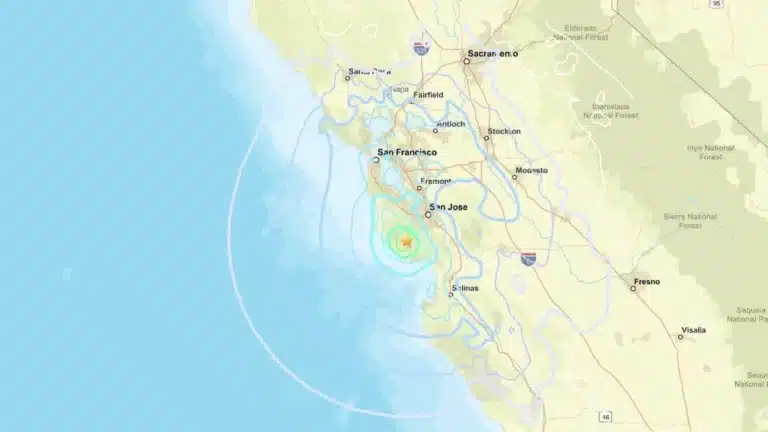
By – Rihem AkkoucheMagnitude 4.6 Earthquake Strikes Near Boulder Creek, Shakes Bay Area
A 4.6 earthquake near Boulder Creek rattled Santa Cruz County early Thursday, sending tremors across the Bay Area and reigniting…
By – Rihem AkkoucheGoliath Ventures Filed for Chapter 11 as Alleged $328M Crypto Scheme Unravels
A Cautionary Tale in Crypto’s Wild Frontier The downfall of Goliath Ventures underscores the volatility—and vulnerability—of the crypto investment landscape.…
By – Rihem AkkoucheOhio State Suspends Fraternity After Student Hospitalization
A Developing Investigation With High Stakes The Ohio State suspends Fraternity case now moves into an investigative phase, where unanswered…
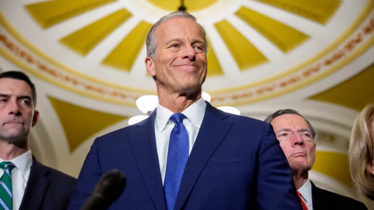
By – Rachel MooreSenate Vote on DHS Shutdown Ends Weeks-Long Standoff
Uncertain Path in the House House Speaker Mike Johnson has already criticized the piecemeal approach, calling it “shameful” to leave…
By – Rihem AkkoucheMike Fincke Space Medical Incident Stuns NASA as Mystery Illness Strikes in Orbit
Looking Ahead Despite the Unknown Though the mystery remains unsolved, Fincke’s outlook is anything but dim. Known for his resilience,…
By – Rihem AkkoucheArizona Man Accused of Crucifying Pastor Pushes Judge For A Quick Death Sentence
By Samuel A. Lopez | USA Herald – An Arizona courtroom is now the center of a deeply disturbing case…
By – Samuel LopezTrump’s Laser Talk Sparks New Questions About America’s Secret Arsenal
And that brings us to the battlefield footage. There has been a flood of video from the U.S.-Israel-Iran battles. Some…
By – Samuel LopezThe Northern Lights Return
The Northern Lights have a chance to be visible from several northern U.S. states on Tuesday night, forecasters at the…
By – Jackie AllenFebruary Unemployment Up as Job Losses Surprise Economists
According to the BLS: Producer prices rose 2.9% year-over-year through January 2026 Core PPI increased 3.6%, excluding food and energy…
By – Jackie AllenLate-Night Attack by Venezuelan National at Florida Beach
Officials noted that the suspect had overstayed his work visa at the time of the attack. For more details on…
By – Jackie AllenAnnie Altman Files Amended Lawsuit Against Brother Sam Altman In Federal Court As Filing Revives Explosive Abuse Allegations
CASE AT A GLANCE A dismissed lawsuit involving one of the most powerful figures in artificial intelligence has unexpectedly been…
By – Samuel LopezOpenAI Isn’t Just Buying A Podcast It’s Buying Influence In The AI Narrative War
INSIDE THIS REPORT A century-old strategy is quietly resurfacing as tech giants move to control not just platforms—but the conversations…
By – Samuel LopezPennsylvania Man Pleads Guilty In Federal ‘Animal Crush’ Video Case As Authorities Warn of Expanding Underground Market
Private, invitation-only chat groups Payment channels facilitating anonymous or semi-anonymous transactions Commission-based content production Distribution networks designed to evade detection…
By – Samuel LopezRep. Tim Burchett Warns Classified UAP Briefing Contains Explosive Information That Could ‘Set the Earth on Fire’
WASHINGTON — Rep. Tim Burchett (R-Tenn.), a vocal advocate for UAP transparency and member of the House Task Force on…
By – Samuel LopezNational Security Intelligence Report: Clear And Present Danger – Iran’s Cyber War Against America
PART II: IMPLICATIONS FOR U.S. BUSINESS AND CRITICAL INFRASTRUCTURE A Nation’s Vulnerabilities Laid Bare The United States has constructed much…
By – Samuel LopezUS Intel Finds Iran Retains Key Strike Capabilities Despite Weeks of Attacks
Recent U.S. intelligence assessments indicate that Iran continues to possess a substantial capacity to launch missiles and deploy drones, even…
By – Tyler BrooksHUMANITY RETURNS TO THE MOON: NASA’s Artemis II Lifts Off — First Crewed Lunar Mission In 53 Years
WHAT MATTERS NOW Four astronauts are en route to the Moon for the first time since 1972. History is being…
By – Samuel LopezHealth Insurers 19% Claims Refusal Raises Alarm Across ACA Marketplace
A new analysis reveals a striking reality: health insurers 19% claims refusal has become a defining feature of coverage on…
By – Rachel MooreHospitals Threatened by Medicaid Cuts Face Growing Crisis Nationwide
A sweeping new analysis warns that hospitals threatened by Medicaid cuts are edging toward a breaking point, with hundreds of…
By – Rachel MooreIsometric Workouts Gain Attention as Time-Efficient Path to Better Health
For many people, fitness conjures images of long hours spent running on treadmills, powering through burpees or lifting heavy weights.…
By – Tyler BrooksHow Much Screen Time Is Safe for Kids Under Five?
Fast-Paced Content Researchers at the Institute for the Science of Early Years at the University of East London are examining…
By – Tyler BrooksNew Therapies Offer Hope for Lasting Relief From Hay Fever
A new generation of treatments is renewing hopes that seasonal allergies could one day be controlled at their source, rather…
By – Tyler BrooksJavon Vital Commits to USC Football Program
Lake Charles College Prep standout Javon Vital, one of Southwest Louisiana’s most versatile athletes, pledged his future to the University…
By – Tyler BrooksJudge Allows Tiger Woods to Travel Abroad for Medical Treatment
By – Tyler Brooks
Italy Misses Third Consecutive World Cup After Shootout Loss to Bosnia-Herzegovina
Structural Challenges in Italian Football Experts cite long-term issues in player development and league policies. The Bosman ruling of 1995,…
By – Tyler BrooksMen’s March Madness Elite 8 Delivers High-Stakes Drama as Title Race Tightens
Purdue Faces Uphill Battle Against Arizona Purdue boasts the nation’s top offense, powered by Braden Smith and Oscar Cluff, but…
By – Rihem AkkoucheThe World Cup Security Reckoning: Trump Warns Iran Soccer Team About Safety As War Tensions Spill Into Global Sports
By Samuel A. Lopez | USA Herald – A short Truth-Social post from President Donald Trump on Thursday morning is now…
By – Samuel LopezLate-Night Attack by Venezuelan National at Florida Beach
Officials noted that the suspect had overstayed his work visa at the time of the attack. For more details on…
By – Jackie AllenNo posts found.
No posts found.
 No comments yet. Be the first to comment!
